Printed Maps
Professional, planning‑ready printed maps designed for architects, surveyors and property professionals. Each map is produced using high‑accuracy Ordnance Survey data and delivered on clean, modern templates that look polished in planning submissions, design reports and presentation packs. Choose from digital PDFs or JPG, all prepared to the standards expected by UK planning authorities
Why Printed Maps Matter
Printed maps remain essential for planning applications, design reviews and client presentations. They provide a clear, authoritative view of a site without the need for specialist software, making them ideal for planning officers, consultants and stakeholders who rely on physical documents.
Our printed maps are designed to meet these expectations: crisp layouts, compliant scales, professional title blocks and fully licensed Ordnance Survey data — all prepared instantly through Mapdata.uk..
What We Provide
Planning‑Ready Templates
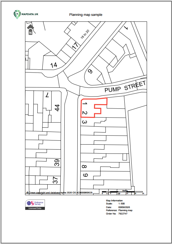
Maps are delivered on clean, professional templates with clear title blocks, north arrows, scale bars and annotation space. Ideal for planning submissions and design documentation.
Accurate Ordnance Survey Mapping
High‑quality OS MasterMap and planning‑scale mapping (1:1250, 1:500, 1:200) using the latest version of OS MasterMap available.
Digital & Printed Options
Choose between: High‑resolution PDF and JPEGs.
Built‑In Compliance
Every printed map includes the required Ordnance Survey copyright notice and licence number, clearly displayed for full compliance.
Sample Pricing
| Product | Scale | Price |
|---|---|---|
| Ordnance Survey Mastermap | @1:200 (0.13 ha) | £9.50 + VAT |
| @1:500 (0.8 ha) | £9.50 + VAT | |
| @1:1250 (5 ha) | £18.50 + VAT | |
| @1:2500 (19.97ha) | £52.25 + VAT |